| Lokalzeit | 2013-06-08 05:06:04 |
|---|---|
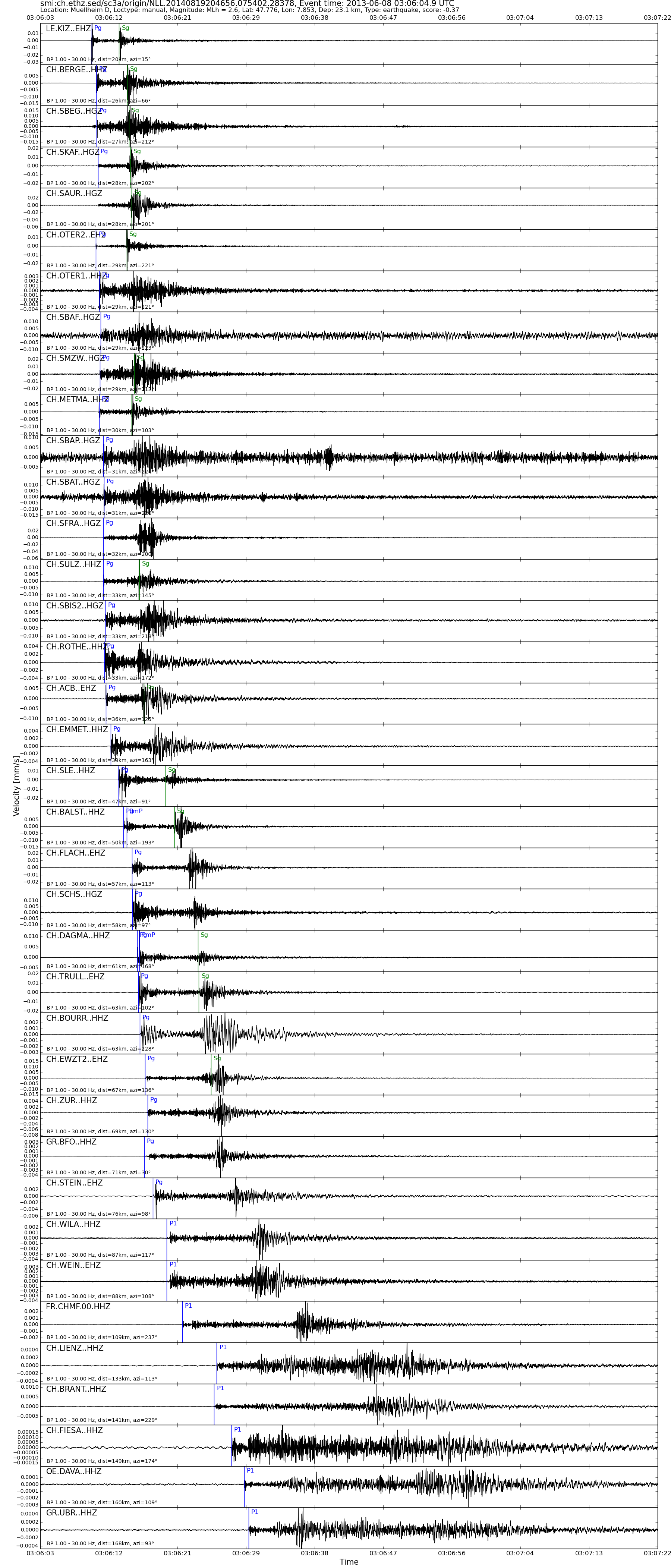
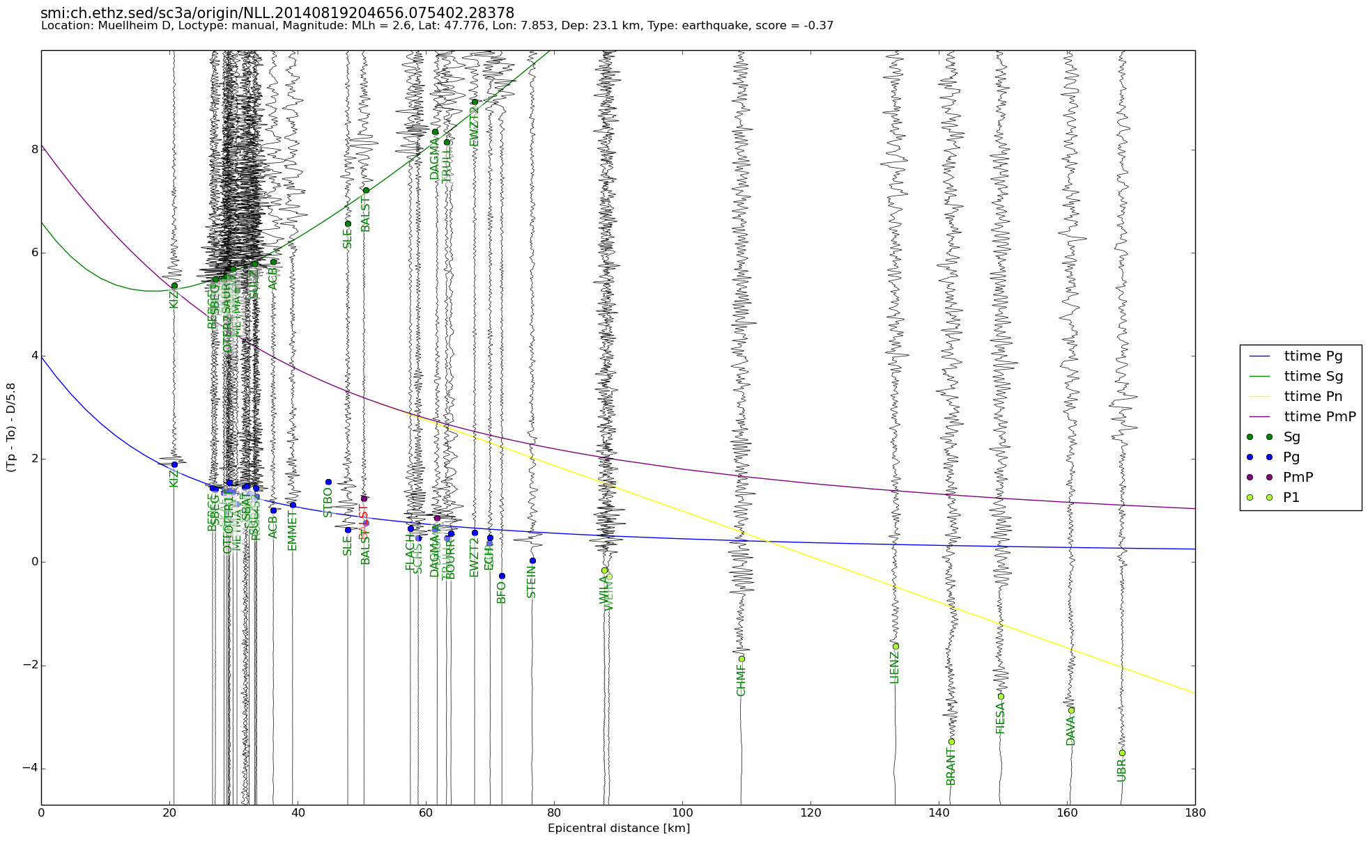
| UTC time | 2013-06-08 03:06:04 |
| Ereignis-Typ | earthquake |
| Breite / Länge | 47.78 / 7.85 |
| Schweizer Koordinaten | 631041 / 291830 |
| Magnitude | 2.6 |
| Magnitudentyp | MLh |
| Ort | Muellheim D |
| Herdtiefe [km] | 23.1 |
| Auswertung | manual |
| Dienst | SED |
| Letzte Änderung | 19-08-2014 20:47:08 |
| Gefahrenstufe | - |
| Origin ID & Metadaten | smi:ch.ethz.sed/sc3a/origin/NLL.20140819204656.075402.28378 |